 |
 |
 |
 |
 |
 |
 |
 |
 |
 |
 |
 |
 |
Lower Mudstone Unit |
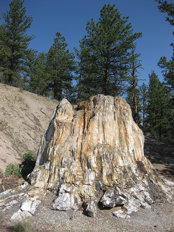
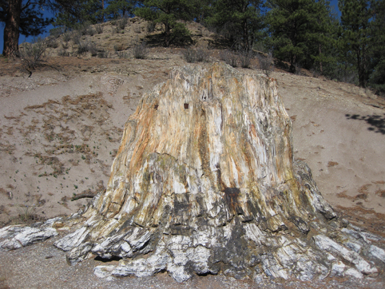 “Big Stump” Sequoioxylon pearsallii Type Specimen (Andrews 1936) Eocene; Florissant Formation Colorado |
The Lower Mudstone Unit The lower mudstone unit consists of mudstones, conglomerates, and sandstones. Ribbons of sandstones and conglomerates within this unit trace the course of stream channels. The lower mudstone unit represents a river system within the Florissant Valley. A 5 meter layer of sandy mudstone at the top of this unit records a lahar deposit that buried parts of a forest growing by the stream in the ancient Florissant valley. The mudflow represents a single event that encased trees in situ (Gregory-Wodzicki, 2001, p.164). Over time, trees buried in place were permineralized with silica released from the volcanic rocks to form a petrified forest. The lower mudstone unit is exposed behind the Big Stump with the middle shale unit and caprock conglomerate above. |
 Close-up of Sandy Mudstone |
|
Bibliography |
Evanoff, E., McIntosh, W.C. and Murphey, P.C. (2001). Stratigraphic Summary and 40Ar/39Ar Geocrhonology of the Florissant Formation, Colorado. In Evanoff, E., Gregory-Wodzicki K.M. and Johnson, K.R. [Eds.] Fossil Flora and Stratigraphy of the Florissant Formation, Colorado. (pp. 1-16). Proceedings of the Denver Museum of Nature and Science, series 4, number 1. Gregory-Wodzicki, K. M. (2001). Paleoclimatic Implications of Tree-Ring Growth Characteristics of 34.1 Ma Sequoioxylon pearsallii from Florissant, Colorado. In Evanoff, E., Gregory-Wodzicki K.M. and Johnson, K.R. [Eds.] Fossil Flora and Stratigraphy of the Florissant Formation, Colorado. (pp. 163-186). Proceedings of the Denver Museum of Nature and Science, series 4, number 1. |
 “Big
Stump” Sequoioxylon pearsallii
“Big
Stump” Sequoioxylon pearsallii