 |
 |
 |
 |
 |
 |
 |
 |
 |
 |
 |
 |
 |
Florissant, Colorado: Geology |
Pikes
Peak Granite Pikes Peak, at an elevation of 4,300 m, is just 19 km southeast of Florissant. Pikes Peak granite has a radiometric age of 1,080 Ma (Evanoff, McIntosh & Murphy, 2001, p. 3). The billion year old pink Pikes Peak granite formed as an intrusive batholith during the Precambrian and covers 2,978 square kilometers (Foos & Hannibal, 1999, p. 1). The mountain building episode known as the Larimide Orogeny, which started in the Late Cretaceous 65 to 70 Ma ago, created the current Rocky Mountains and resulted in the uplift and exposure of the Pikes Peak Granite (Meyer, 2003, p. 23). During the Late Eocene, rivers eroded the granite to form a valley. Late Eocene sediments from volcanic activity, lakes, and rivers, filled the valley depositing the rock units in the Florissant Formation. |
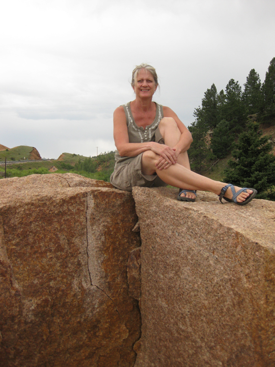 Mary Klass, resting comfortably atop Pikes Peak Granite |
Wall Mountain Tuff
The Wall Mountain Tuff, dated at 36.7 Ma, records the oldest known Paleogene volcanic activity at Florissant. An explosive volcanic eruption 80 km to the west of Florissant resulted in a pyroclastic flow--an incandescent cloud of gas and debris with temperatures of 1,000 degrees Celsius traveling at speeds of 160 km/h or more. The gasses in ash flows suspend the hot debris, which allow the volcanic material to travel as far as 120 km or more (Matthews, KellerLynn & Fox, 2003, p. 10). The pyroclastic flow followed the contours of the landscape and swept through the Florissant valley. As the flow came to rest, the hot material fused into an ignimbrite or welded rhyolitic tuff. The Wall Mountain Tuff carpeted the Florissant paleovalley and, subsequently, experienced erosion before the deposition of the Florissant Formation. Unconformities represent gaps in the sedimentary geologic record between two rock masses of different ages and indicate that the deposition of sediments was not continuous. An unconformity can represent either time during which no sediments were deposited or time during which rock layers have been eroded away. The unconformity between the Pikes Peak Granite and the Wall Mountain Tuff represents 1.04 billion years of missing time. All of the Paleozoic, Mesozoic, Paleocene and early Eocene rock units have been eroded away (KellerLynn, 2006, p. 21). Today, outcrops of the Wall Mountain Tuff appear throughout the Florissant Valley. Remnants of the Wall Mountain Tuff in Castle Rock, just south of Denver, indicate that this ancient pyroclastic flow traveled at least 150 km from the eruption site (Meyer, 2003, p. 25). Castle Rock Rhyolite is a dimensional stone made from the Wall Mountain Tuff. The gray blocks used to construct Molly Brown’s house were quarried from the Wall Mountain Tuff in Castle Rock (Mathews et al., 2003, p. 122). Another
unconformity lies between the eroded surface of the Wall
Mountain Tuff and younger sedimentary rock units. In
most areas the unconformity is between the Wall Mountain
Tuff
and the Florissant Formation. There are some places in
which the Florissant Formation abuts laterally against
the Wall Mountain Tuff, an unusual arrangement for an
unconformity. On the southeast side of the monument it
lies between the
Wall Mountain Tuff and the Tertiary boulder conglomerate.
The Tertiary boulder conglomerate contains boulders and
cobbles of granite, gneiss, schist, clasts of tuff from
the Wall Mountain Tuff and fragments of petrified wood.
Streams and debris flows deposited the Tertiary boulder
conglomerate. This unconformity represents missing time
during the Eocene (Evanoff et al., 2001, p. 4; KellerLynn,
2006, p. 21 & 25).
|
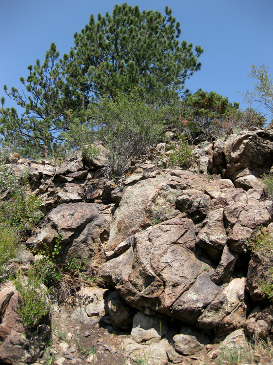 Wall Mountain Tuff Exposure at Barksdale Picnic Area |
| Florissant Formation Two million years after the formation of the Wall Mountain Tuff, volcanic activity in an area known as the Thirtynine Mile volcanic field, located a mere 25 to 30 km southwest of the ancient Florissant basin, would help to form the famous fossil beds at Florissant. The Guffey volcano was situated among a cluster of towering stratovolcanoes within the Thirtynine Mile area. Eruptions from the Guffey volcano produced pyroclastic flows, ash falls, and lahars (volcanic mudflows). Periodically, the lahars acted as dams to the Florissant valley, creating ancient Florissant lakes (Evanoff et al., 2001, p. 8). The rock units of the Florissant Formation record the existence of rivers, volcanic activity, and lakes within Florissant valley. Fossils from some of these rock units faithfully record portions of Florissant ecosystems of the Late Eocene. The Florissant Formation was deposited upon the eroded surfaces of the Pikes Peak Granite and the Wall Mountain Tuff. Six informal units make up the Florissant Formation and include from bottom to top: the lower shale, the lower mudstone, the middle shale, the caprock conglomerate, the upper shale, and the upper pumice conglomerate (Evanoff et al., 2001, p. 8). Multiple lines of evidence indicate a late Eocene age for the Florissant Formation, which accords with the current placement of the Eocene-Oligocene boundary at 33.7 Ma. The Florissant Formation is dated at 34.07 Ma based on volcanic minerals in the formation (Evanoff et al., 2001, p. 14). The overlapping range of brotontheres and Mesohippus indicates a Chadronian age (37-34 Ma) for the mammalian fauna of Florissant. The 70 meter Florissant Formation is almost entirely reversed in polarity and is most logically correlated with Chron C13, which spans 33.7-34.7 Ma (Prothero & Sanchez, 2004, p. 145). Thus, radiometric dating, mammalian fossil fauna, and the magnetic stratigraphy of Florissant corroborate a latest Eocene age for the Florissant Formation. The Florissant Formation represents both fluvial (river) and lacustrine (lake) environments. An initial lake in the paleovalley became filled with sediments over many years, after which a stream valley developed. Evidence suggests lahars traveling down side tributary valleys eventually formed a natural dam, re-establishing lake conditions. Renewed volcanic activity resulted in a lahar deposit that entered parts of the second reservoir-like lake. Eventually, the deposition of a pumice conglomerate marks the end of lake conditions. Let’s take a closer look at the major units in the Florissant Formation. Lower Shale UnitThe lower shale unit represents deposition within an early Florissant lake and is composed of alternating paper shale and tuffaceous siltstone. Volcanic conglomerates are also interspersed throughout the unit. Repeated deposition of ash and clay at the bottom of Lake Florissant trapped a variety of organisms. The shale from this unit contains the fossils of plants, insects, fish, and birds. Insects and leaves from the lower shale unit can be collected at the private Florissant Fossil Quarry, just outside Florissant Fossil Beds National Monument. |
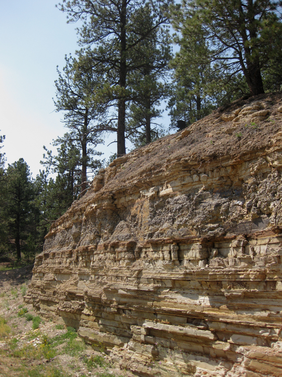 Lower Shale Unit at Florissant Fossil Quarry |
Lower Mudstone Unit The lower mudstone unit consists of mudstones, conglomerates, and sandstones. Ribbons of sandstones and conglomerates within this unit trace the course of stream channels. The lower mudstone unit represents a river system within the Florissant Valley. A 5 meter layer of sandy mudstone at the top of this unit records a lahar deposit that buried parts of a forest growing by the stream in the ancient Florissant valley. The mudflow represents a single event that encased trees in situ (Gregory-Wodzicki, 2001, p.164). Over time, trees buried in place were permineralized with silica released from the volcanic rocks to form a petrified forest. The lower mudstone unit is exposed behind the Big Stump with the middle shale unit and caprock conglomerate above. |
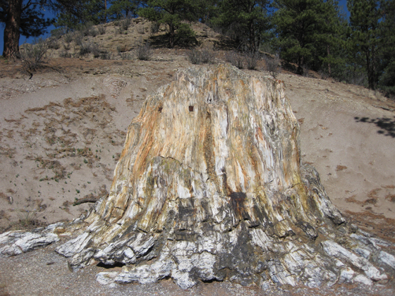 “Big Stump” Type Specimen Sequoioxylon pearsallii (Andrews 1936) Eocene; Florissant Formation Colorado |
Middle Shale Unit Additional lahars flowed down the valley eventually damming the Florissant drainage. Water filled the valley and its tributaries forming a second lake Florissant, which was 1.5 kilometers wide and 20 km long (Meyer, 2003, p. 29). The middle shale unit consists of paper shales, pumice conglomerate, and volcanic siltstone beds (Evanoff et al., 2001, p. 7). Paper shales found within the Florissant Formation consist of alternating layers of diatomite and volcanic ash-clay. Repeated deposition of volcanic ash within the lake triggered abundant diatom growth. Fossils are found within the layers formed by the deposition of diatoms (O’brien, Meyer, Reilly, Ross, and Maguire, 2002). Within the monument, it is the middle shale unit that provides the wealth of fossil insects and leaves. Fossils of fish, mollusks, and ostracods are rare within the middle shale unit. Caprock Conglomerate The caprock conglomerate consists of granular muddy conglomerate beds. The caprock conglomerate overlies parts of the middle shale unit and protects it by slowing the erosional process. The caprock conglomerate represents debris flow perhaps a lahar that entered the lake. The middle shale unit and caprock conglomerate can be seen in several locations along the trails. |
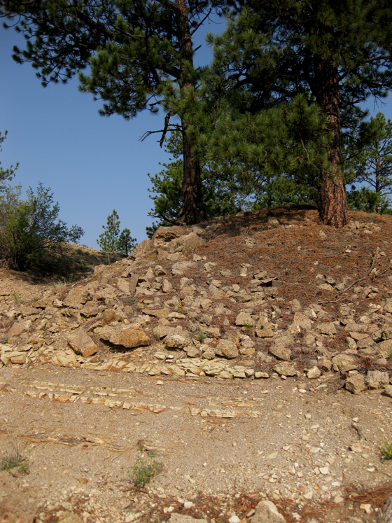 Middle Shale Unit and Caprock Conglomerate |
Upper Shale Unit The upper shale unit follows the caprock conglomerate and represents lacustrine or lake deposition after the lahar entered the lake. In the northwest corner of the monument the upper shale unit overlies the middle shale unit. Like the middle shale unit, the upper shale unit consists of alternating paper shales and pumice conglomerate beds. Fossils of plants, insects, fish scales and ostracods are found within this unit. The upper shale unit is different from the middle shale unit in its abundance of ostracods and fingernail clam shells (Evanoff et al., 2001, p. 11). The upper shale unit is exposed along Boulder Creek. |
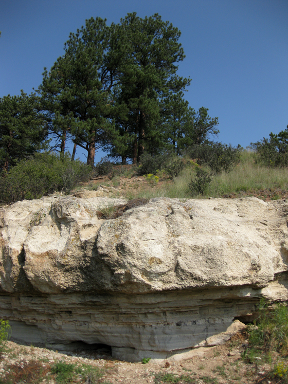 Florissant Upper Shale and Upper Pumice Conglomerate |
The
youngest unconformity rests between the upper pumice conglomerate
and Quaternary deposits. This unconformity represents 32
million years of missing time from the Oligocene, Miocene,
and Pliocene Epochs (KellerLynn, 2006, p. 21). Pleistocene
deposits at Florissant are composed of weathered and eroded
Pikes Peak Granite, Wall Mountain Tuff, and fragments of
shale, mudstone, sandstone, and fossil wood from the Florissant
Formation. Parts of the Florissant Formation that have
survived weathering and erosion are exposed around the
perimeter of the old lake (KellerLynn, 2006, p. 26). |
Bibliography |
| Evanoff,
E., McIntosh, W.C. and Murphey, P.C. (2001). Stratigraphic
Summary and 40Ar/39Ar Geocrhonology of the Florissant Formation,
Colorado. In Evanoff, E., Gregory-Wodzicki K.M. and Johnson,
K.R. [Eds.] Fossil Flora and Stratigraphy of the Florissant
Formation, Colorado. (pp. 1-16). Proceedings of the
Denver Museum of Nature and Science, series 4, number 1. Foos, A. & Hannibal, J. (1999). Geology of Florissant Fossil Beds National Monument. http://www.nature.nps.gov/geology/education/foos/flfo.pdf Gregory-Wodzicki, K. M. (2001). Paleoclimatic Implications of Tree-Ring Growth Characteristics of 34.1 Ma Sequoioxylon pearsallii from Florissant, Colorado. In Evanoff, E., Gregory-Wodzicki K.M. and Johnson, K.R. [Eds.] Fossil Flora and Stratigraphy of the Florissant Formation, Colorado. (pp. 163-186). Proceedings of the Denver Museum of Nature and Science, series 4, number 1. KellerLynn, K. (2006). Florissant Fossil Beds National Monument Geologic Resource Evaluation Report. Natural Resource Report NPS/NRPC/GRD/NRR—2006/009. National Parks Service, Denver, Colorado Matthews, V., KellerLynn, K., and Fox, B. (2003). Messages in Stone: Colorado’s Colorful Geology. Canada: Colorado Geologic Survey. Meyer, H.W. (2003). The Fossils of Florissant. Washington: Smithsonian Books. O’Brien, N.R., Meyer, H.W., Reilly, K., Ross, A.M., and Maguire, S., (2002). Microbial taphonomic processes in the fossilization of insects and plants in the late Eocene Florissant Formation, Colorado: Rocky Mountain Geology, v. 17, pp. 1-11). Prothero, D.R. and Sanchez, F., (2004). Magnetic stratigraphy of the upper Eocene Florissant Formation, Teller County, Colorado. In Lucas, S.G., Zeigler, K.E., and Kondrashov, P.E. [Eds.]. Paleogene Mammals. (pp. 129-135). New Mexico Museum of Natural History and Science Bulletin 26. |